Projects & Field Experience

Survey Projects & Field Demonstrations

Explore the task, navigation setup and measurement workflow behind two multibeam survey records. See installation and calibration photographs alongside the resulting sections, point clouds and terrain views.

Historical records from 2019, followed by additional vessel and installation references.

Historical application record

Bridge-Pier Multibeam Survey in Jiujiang

Jiujiang, China

Survey task
Survey the underwater bridge-pier area and riverbed approximately 200 m upstream and downstream of Jiujiang Second Yangtze River Bridge.
System configuration
iPos MS11 · iBeam8120 · Swiftsvp sound velocity profiler
In the record
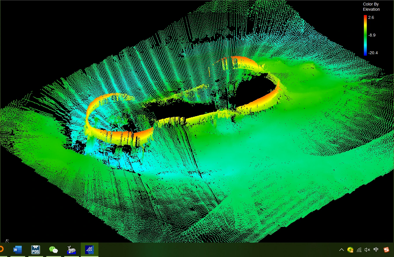
Measured sensor offsets, installation calibration and cross-sections accompany the 3D point cloud around pier 22.

A documented application of iPos MS11 in a bridge-area multibeam survey.
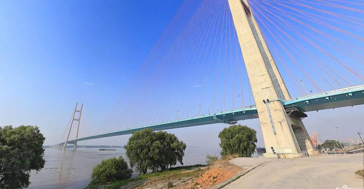
Jiujiang Second Yangtze River Bridge viewed from the riverbank
Jiujiang Second Yangtze River Bridge, the setting for the September 2019 survey.
Three-dimensional point cloud showing the underwater area around bridge pier 22
Three-dimensional point cloud around pier 22. The view shows the surveyed underwater geometry.

Field demonstration

Multibeam Survey Field Demonstration in Bangkok

Bangkok, Thailand

Survey task
Demonstrate a combined navigation and multibeam survey workflow in a Bangkok harbour basin, from installation and calibration to acquisition and terrain review.
System configuration
iPos MS11 · iBeam8120 multibeam system
In the record
Calibration profiles, 3D terrain outputs and a reciprocal-line consistency check document the measurement workflow.

The field record describes RaysenNav participation in installation, commissioning and workflow demonstrations.

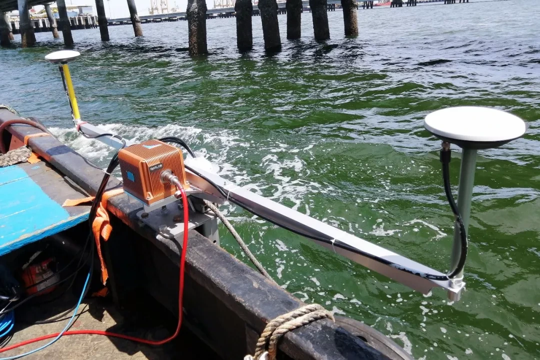
Survey vessel with navigation equipment and two GNSS antennas beside quay piles in Bangkok
Navigation equipment and antennas aboard the vessel in the Bangkok harbour basin, August 2019.
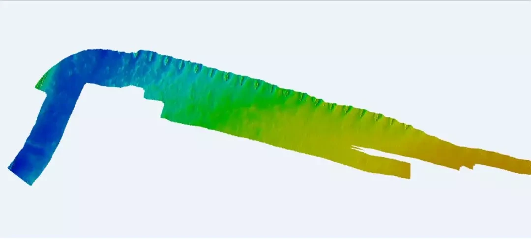
Colour-coded three-dimensional terrain model from the Bangkok harbour-basin survey
Terrain output generated in HiMAX MBE from the harbour-basin survey data.

More from the field

Vessels, installations & working environments.

Additional photographs offer references for vessel layout, mounting space and site conditions.

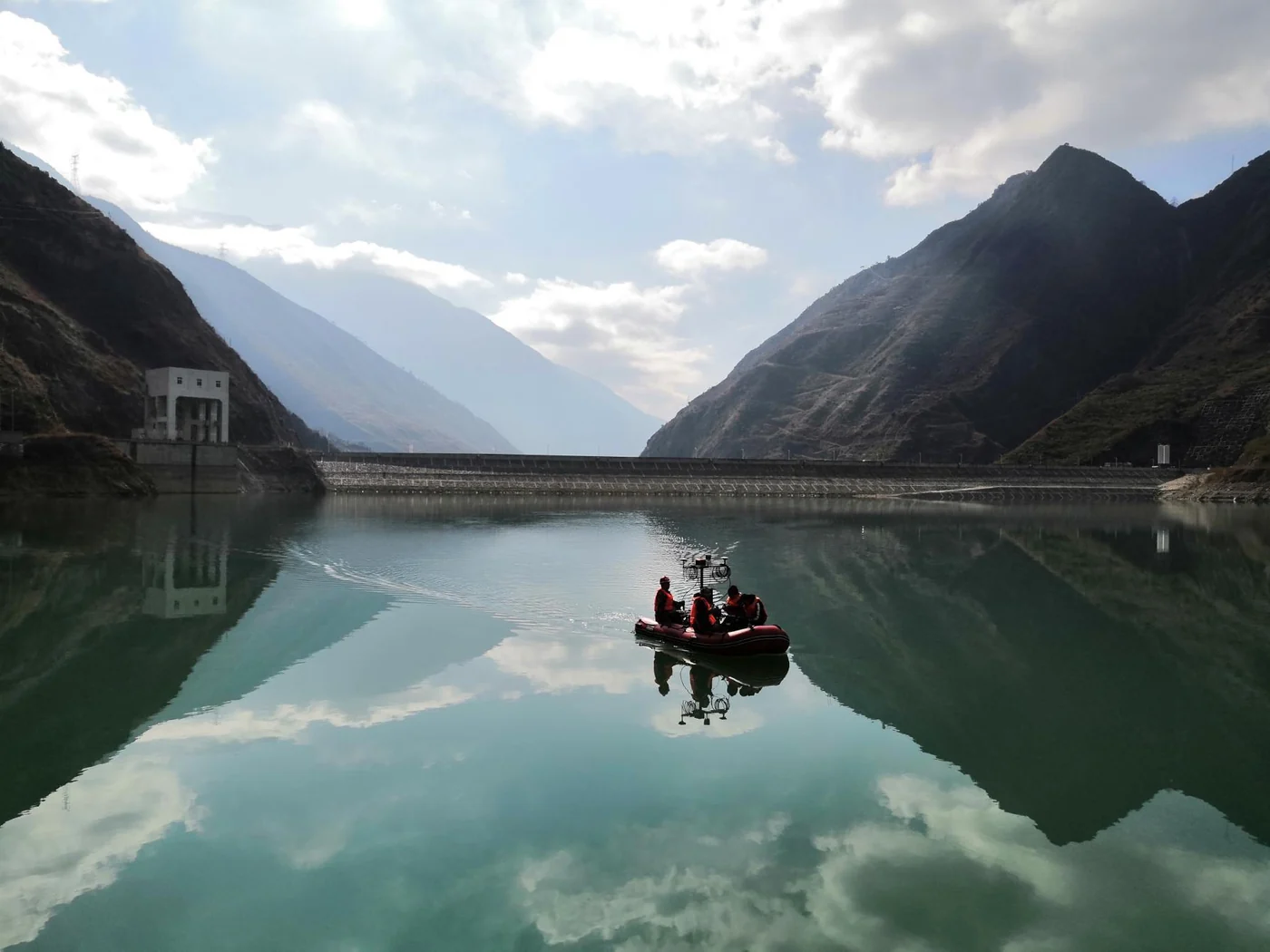
Survey vessel operating on a reservoir.

INLAND WATERS

Reservoir surveying

Survey equipment deployed on a compact vessel in a reservoir environment. A field reference for discussing vessel layout and navigation integration.

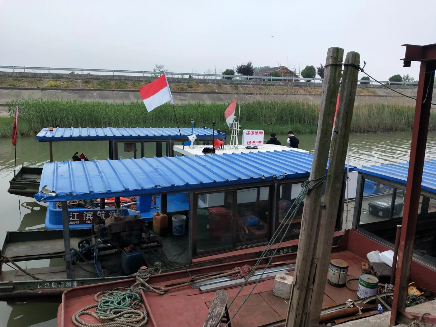
Survey vessel and onboard equipment on an inland waterway.

RIVERS & WATERWAYS

Inland waterway surveying

Vessel-based survey activity in an inland waterway. These photographs show the operating environment and onboard arrangement.

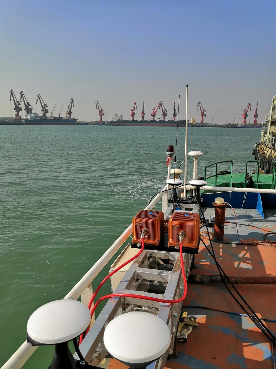
Onboard equipment arrangement near a working port.

MARINE SURVEY

Marine surveying in Lianyungang

Navigation equipment and dual antennas installed on a survey vessel in a marine working environment.

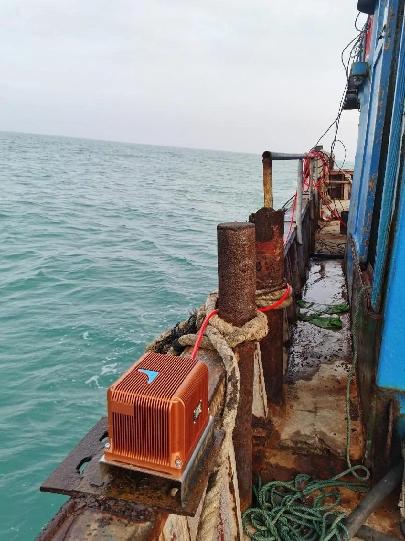
Navigation equipment installed on a coastal vessel.

COASTAL WATERS

Coastal survey deployment

Navigation equipment mounted along the side of a coastal vessel, showing the mounting space and working conditions.

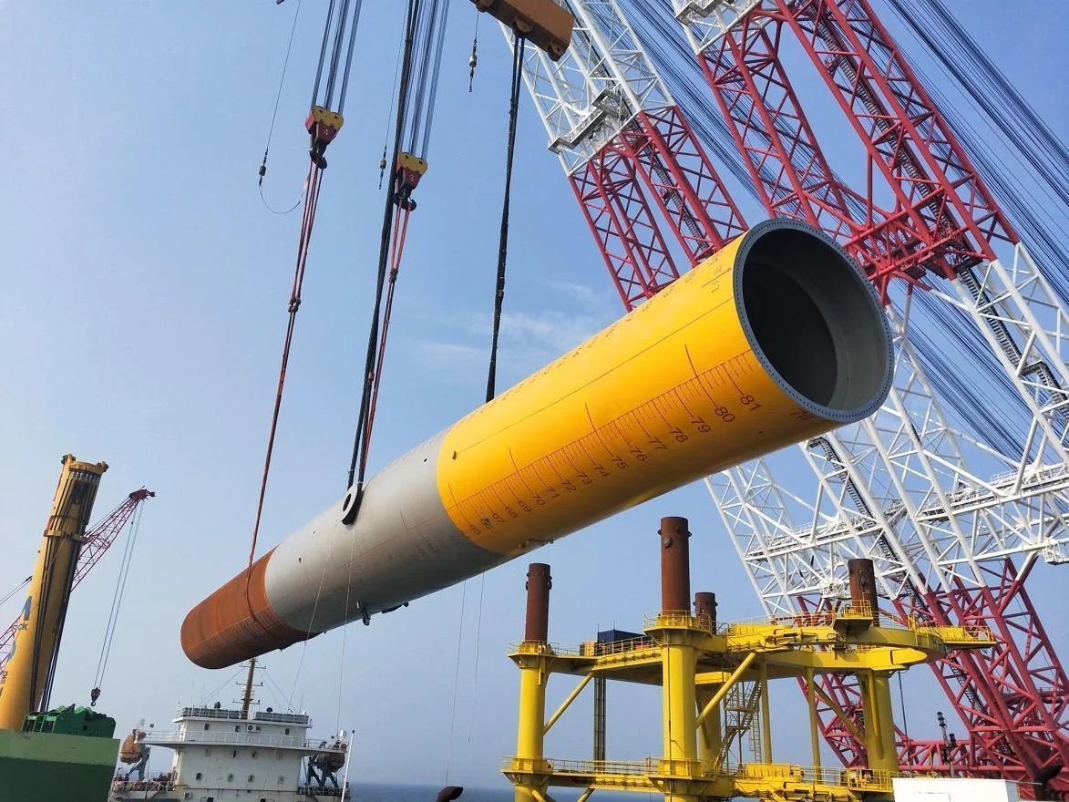
Lifting equipment in a wind energy project environment.

OFFSHORE FIELD EXPERIENCE

Wind energy project environment

Field photographs from a wind energy project. The images document the site environment and do not establish a specific control task or measured performance result.

These additional photographs document field environments and installations. They do not establish specific product models or independently verified performance results.

Explore hydrographic surveying

Related navigation systems

Review your survey setup.

Compare the iPos MS series and review sensor geometry, navigation outputs and integration requirements.

Explore iPos MS

Application context

Understand the system relationship.

See how position and attitude information fits alongside the sonar, acquisition software and vessel installation.

Hydrographic surveying

ENGINEER TO ENGINEER

Planning a similar survey?

Tell us about the task, waterway and vessel, GNSS conditions, existing equipment and required outputs or accuracy. Start with what you know.

Discuss your survey task